Counting
carbon
The argument for GEO-TREES, a standard measure of forest carbon
by Joshua Tewksbury
Joshua Tewksbury, director of the Smithsonian Tropical Research Institute, explains how the development of a global standard measure of forest carbon will jumpstart the carbon economy.
Where I get groceries, a lot of food is sold by weight. There are choices to make—should I buy the expensive apples or the cheaper ones—but I trust the scales at the checkout counter to correctly weigh my produce. Unfortunately, this is not the case in a different sort of market, a market in which measuring weight correctly affects the well-being of my children: the carbon market.
According to records kept by the European Centre for Medium-Range Weather Forecasts since 1940, November 17, 2023, was the first day that that global temperature exceeded 2°C above pre-industrial levels. The impacts of climate change are already causing 100’s of billions of dollars each year in the US alone and there’s a very narrow window of time within which the economies of the world must wean themselves from fossil fuels. This is truly an all-hands-on-deck moment, and many sectors are now waking up to the need to act fast.
One of the best tools we have at our immediate disposal to combat climate change are the world’s forests, or what is left of them. Humans have removed about half of the forests on this planet, and a significant percentage of what is left is significantly degraded. That said, the remaining forests still store almost 70% of the global biomass of carbon, and the potential for forests to trap and store carbon is far greater than what is being realized—accounting for as much as 10 years of current carbon emissions.
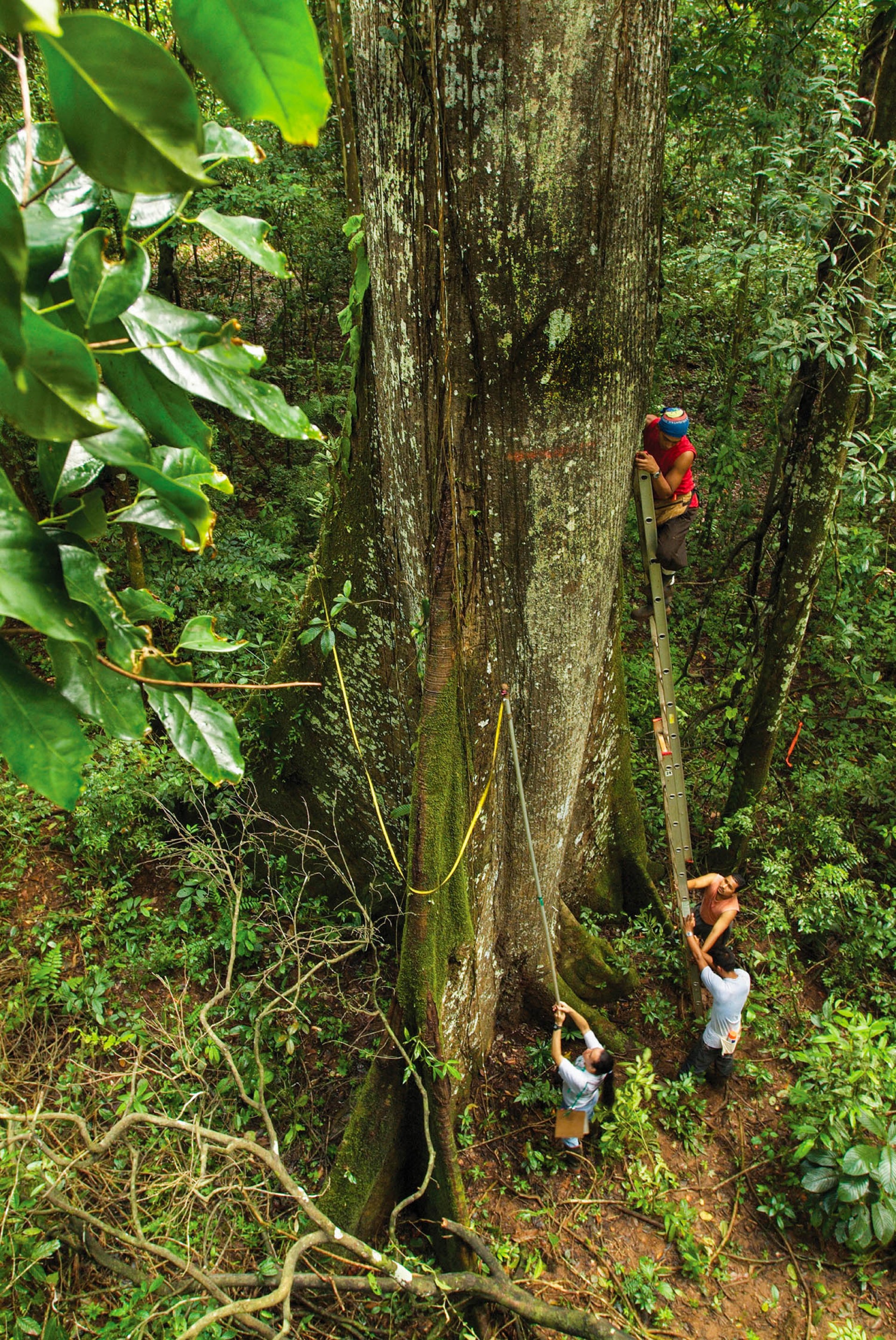
No two forests are the same. For example, tropical forests are composed of hundreds of tree species, each with different wood densities and geometries, and each tree stores a different amount of carbon. To accurately estimate total forest carbon storage based on satellite images, a standard protocol for on-the-ground measurement is key, as are carbon measurements from many different forest types. GEO-TREES trains local foresters and botanists to use LiDAR equipment and data management tools to create a free, online data set as a standard for carbon verification.
Credit: Marcos Guerra, STRI
There is now a huge amount of energy for action – governments are using compliance markets and handing out carbon credits, and companies are leaning into in voluntary carbon markets – investing in projects that trap carbon (often as wood in trees) as a way of offsetting the emissions they cannot avoid. But neither of these markets will work well unless there is a way to measure carbon across different forests—a single international standard—that people everywhere agree upon and trust.
Most of the work to create this standard has actually been done. NASA, the European Space Agency, and others, have spent billions of dollars developing satellites with the ability to image forests, and on models to calculate how much carbon is in forests based on these images, but these projects don’t include any way to calibrate space-based observations with actual measurements on the ground. It is frankly surprising that calibration is not considered fundamental, but sometimes, space scientists and earth scientists don’t have much chance to talk to each other in our siloed world.
What is needed now is a global network of plots where ground-based measurements are used to calibrate space-based observations, serving the same function as the “standard weight” used to calibrate a scale.
Forest scientists involved in the Smithsonian’s Forest Global Earth Observatory program (ForestGEO) and colleagues from around the world are now building this calibration network. This system for global forest carbon verification is called GEO-TREES and we can put this together quickly because we’ve been working with partners around the world to measure the details of the world’s forests for 40 years. With new support from the Bezos Earth fund, ESA, and other partners, and 40 years of support through the Smithsonian, we are establishing a system that will speak directly to space-based observations, and allow free, traceable, trusted measurement standards as a public good. That’s what investors need to be sure that the value of carbon credits based on forests here in Panama is the same across the world in Singapore or Brazil.
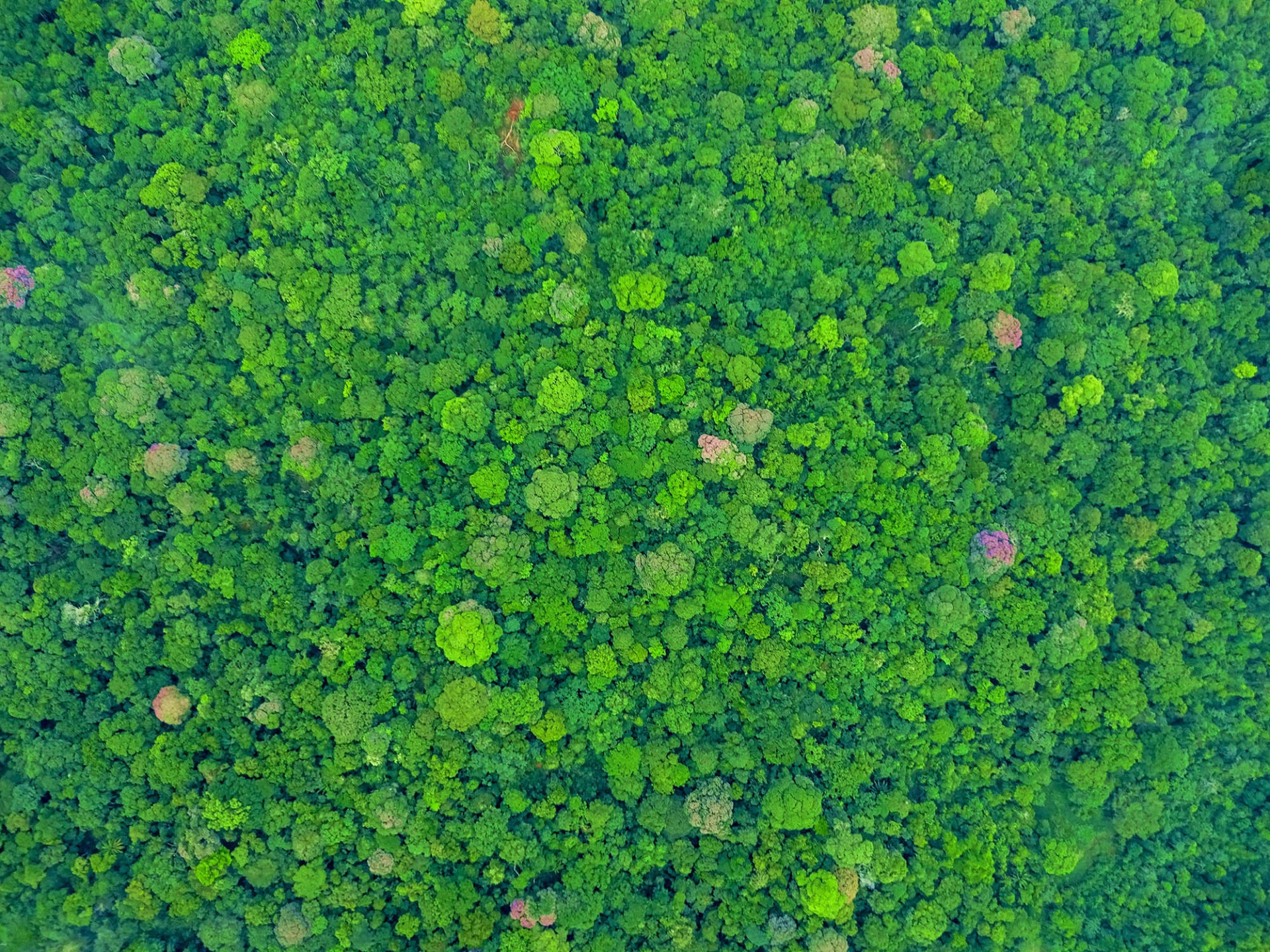
This drone’s-eye-view of the forest on Panama’s Barro Colorado Island, where researchers established a standard way to measure trees in 1980, shows the diversity of trees in a tropical forest canopy.
Credit: STRI
This system consists of measurements of individual trees, ground-based LiDAR, and air-based LiDAR. LiDAR stands for Light Detection and Ranging, a way to visualize forests by bouncing laser light off of them. Scientists established GEO-TREES because without our standardized, impartial, reliable system for forest carbon measurement, the carbon market will not take off. No one will be sure of what they are buying or selling.
Measurement is fundamental. Good measurement has a series of key qualities we seem to forget when it comes to the carbon markets. Good measurements should be repeatable, stable, comparable, involve the right amount of accuracy and an agreed statement of uncertainty. Furthermore, they should be anchored in a standardized measurement system and sanctioned by international measurement and standard structures. We don’t question whether a meter or an ounce is the same in another country. International standards allow trade and coordination of infrastructure and technology, support safety and quality of life, and promote innovation all over the world.
Before I moved to Panama to direct the Smithsonian Tropical Research Institute, I lived next-door to the US National Institute of Standards and Technology (NIST) in Boulder Colorado. It’s windy in Boulder, and the NIST paper trash that would occasionally fly over the fence was covered with equations. My kids would joke that NIST staff were busy calculating the length of the official inch. But the science of metrology has powerful impacts on all of us, and without standards things do not go well. Nowhere is this truer today than in carbon markets.
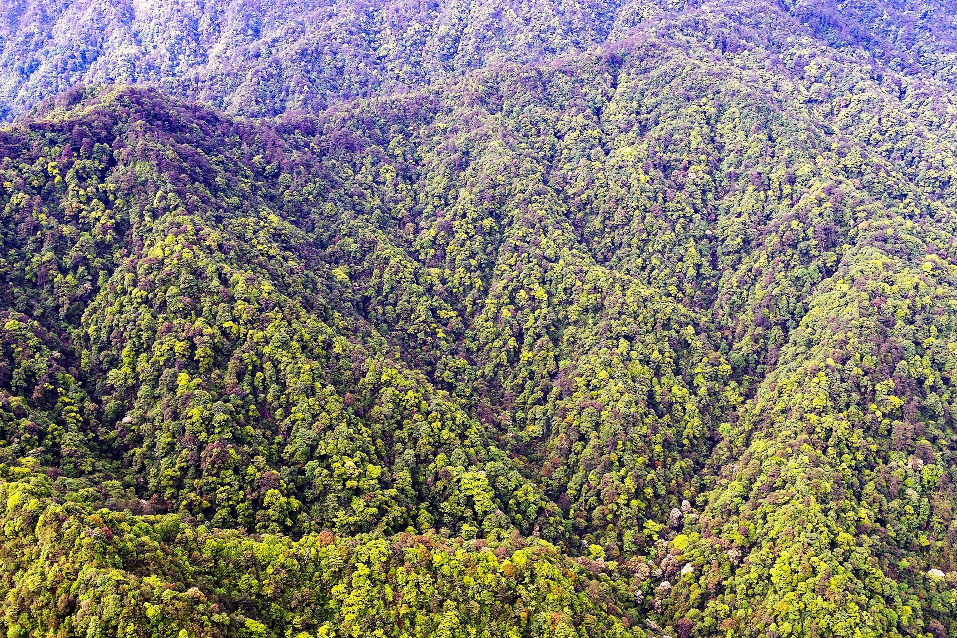
The GEO-TREES network will be based on existing networks of forest research sites and international collaborations. Aerial view of the Gutianshan Forest Dynamics Plot established in 2005, part of the Smithsonian ForestGEO network. In this plot there are 140,700 individual trees with stems greater than 1 cm diameter belonging to 159 species.
Credit: Y. Wang
A critical part of this movement has been to establish carbon markets—in most cases, this involves putting a price on carbon, or carbon equivalents, so that it can be bought and sold.
Forests, and particularly tropical forests, are the best-understood, globally scalable way to pull a significant amount of carbon from the air or keep carbon from getting into the air in the first place through conservation. Add to this the following facts: 1/3 of tropical forests have already been logged, and this land could be reforested, another 1/3 of tropical forests are significantly degraded and in need of restoration. The last intact tropical forests – are being cut down 10 times faster than the rates of deforestation in temperate forests. All of this has led counties, and many companies, to conclude that investing in the protection and restoration of tropical forests is an effective way to lock up carbon and offset the carbon their activities produce.
But carbon markets are not working as planned. Voluntary forest carbon markets are trading at 5% of their value than less than a year ago. Why do we see weekly headlines in the Guardian, the New Yorker, and elsewhere, showing how this market has gone off the rails? And why are big investors—Porche and Gucci and others—putting a hard pause on their entire voluntary carbon market investment portfolios? To some degree, this is because we forgot about metrology, the science of measurement. We have yet to create a standardized, accessible measurement system.
Our system, GEO-TREES, is a consortium of government research organizations, NGOs, space agencies, universities, and research networks that have come together to build a system to fill this need. As our system goes online, the large-scale demand for carbon verification has created space for a range of for-profit startups to raise hundreds of millions of dollars to commodify the same information. These companies are working to combine the best AI-based tools with ground-based observations and space-based measurements to provide clients and investors in forest carbon markets with information on how much carbon is in a particular patch of forest.
Thus today, companies and landowners not only have to figure out where to invest, but they also must figure out which NGO they are going to pay to assess how much carbon is present in each patch of forest. They are essentially standing in a grocery store with their bags of apples, looking at many different checkout counters all with differently calibrated scales, each telling them that only they know how to weigh their produce. And because the voluntary carbon markets are just that—voluntary—company after company is holding off, pulling back, unwilling to make the mistake of going to the wrong checkout line.
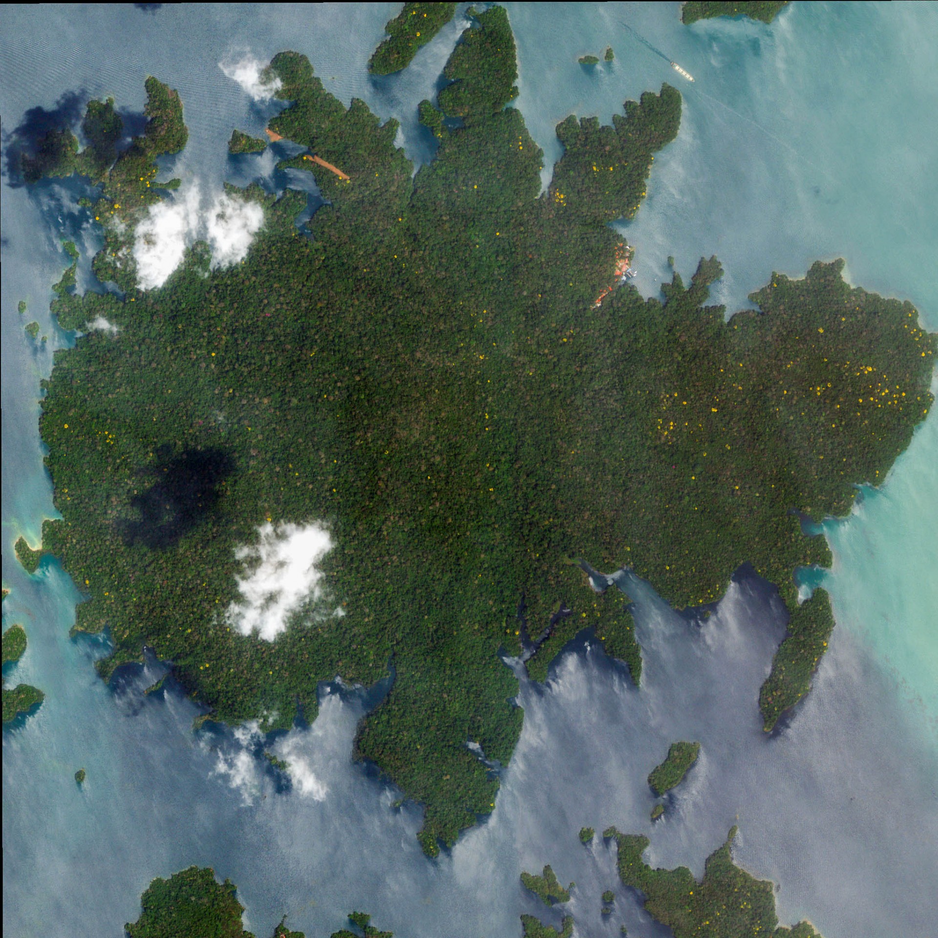
Satellite images are becoming more sophisticated, but, especially for tropical forests, may still be highly inaccurate. Establishing a single forest carbon measurement standard will improve the accuracy of satellite-based carbon estimates.
Credit: STRI
Most of the world’s governments and major companies are lining up to make carbon neutrality pledges and looking for ways to invest in carbon sequestration. Yet, until we agree on a measurement system, we will not be able to act at scale. Unbiased, repeatable, comparable estimates of forest carbon, for any forest, in any condition, with appropriate accuracy and an agreed statement of uncertainty, is a critical first step in opening investment in forest carbon.
The other issues involved in establishing carbon markets cannot be solved unless we first take the measurement issue off the table, the same way we have done in the supermarket. We think that GEO-TREES is the solution.


